Locating the Epicenter of an Earthquake
Objective: To locate the epicenter of an earthquake
Materials Required: Everything that you need for this exercise is included in the on-screen components.
Time Required: 2 hours
You are a scientist working at the national office of the Earthquake Data Control Center. You are able to receive information from several scientific monitoring stations around the world about earthquake activity. A large earthquake has recently occurred. Your task will be to analyze the data that comes to you from various locations around the globe, and then to determine the exact location of this earthquake.
On September 29, 2009, seismic monitoring stations around the Pacific Rim recorded seismograms of a large earthquake. Three seismic stations have sent you their data: Forrest in Australia, Tegucigalpa in Honduras, and Oita Nakatsue in Japan. Each seismic station has actually sent you three seismograms to help you analyze this earthquake. These seismograms represent motion in the east-west direction, the north-south direction, and in the vertical direction. Recording seismograms to represent motion in three directions is quite standard since the originating earthquake can send out seismic waves in many directions. With seismograms for three different directions we can be reasonably sure that at least one, if not more, of those directions will result in a good seismic wave trace as the earthquake passes us by.
Your task is to analyze the data that you have been sent and then to determine the origin of the earthquake. Below is the data that you received from the three seismic monitoring stations:
 Station: Forrest, Western Australia. Print seismic data.
 Station: Tegucigalpa, Honduras. Print seismic data.
 Station: Oita Nakatsue, Japan. Print seismic data.
If you need help analyzing the station data, click the View Answers below.
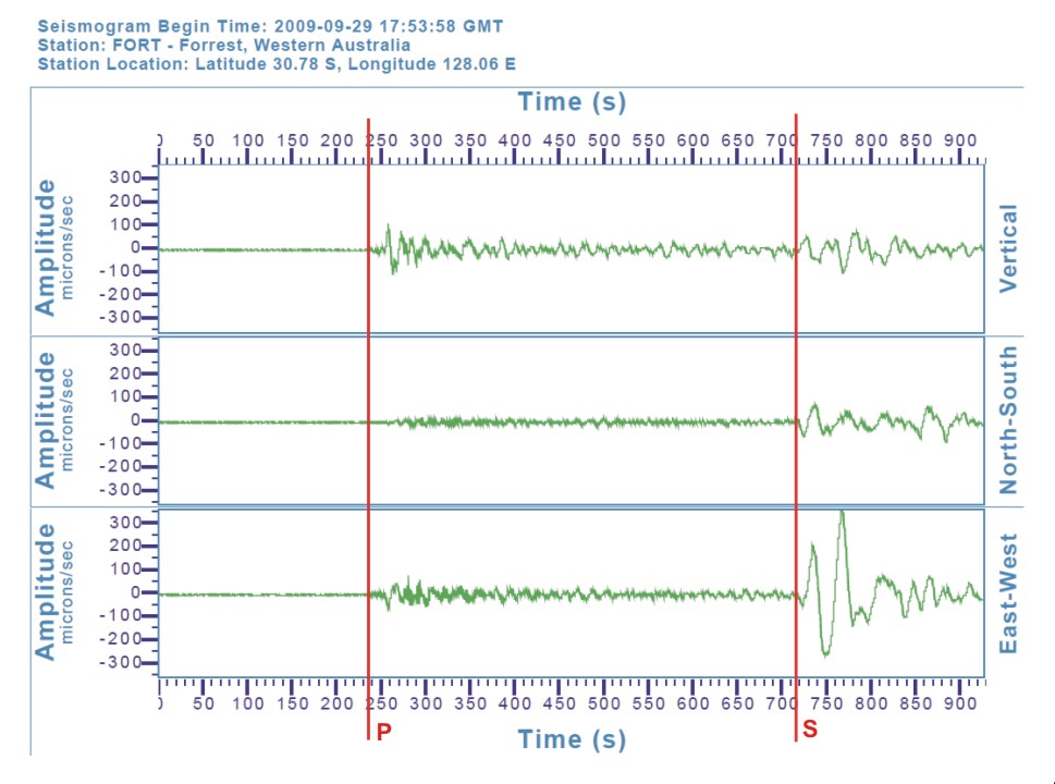 Station: Forrest, Western Australia. P and S wave arrival times have been inserted on top of the data.
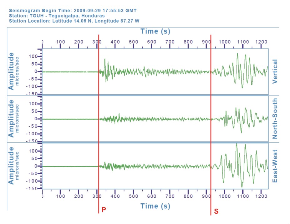 Station: Tegucigalpa, Honduras. P and S wave arrival times have been inserted on top of the data.
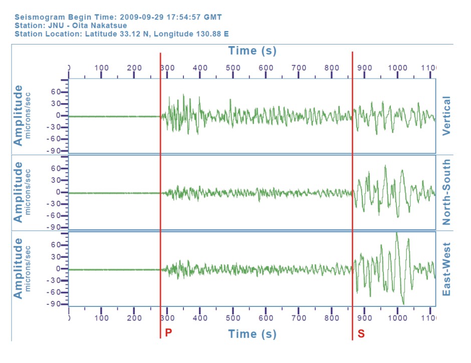 Station: Oita Nakatsue, Japan. P and S wave arrival times have been inserted on top of the data.
- What location (latitude and longitude) did you determine as the earthquake's epicenter?
The earthquake occurred at 15.60 S, and 172.30 W. (Additional background information: The earthquake had a magnitude of 7.9, and occurred at a depth of 85 km.) - What landmasses are close to the earthquake location?
The earthquake occurred south of the Samoan Islands (Samoa and American Samoa). Fiji is further west, while New Zealand is much further south. - What physical landform is at the earthquake's location?
An oceanic trench (Tonga Trench) is located at the earthquake's location. - The earthquake occured between the boundary of which two tectonic plates?
The earthquake occurred at the boundary between the Australian Plate and the Pacific Plate.