D3-2
Water Landforms
Moving water is responsible for the creation of many unique landforms. Some of these landforms include:
- V-Shaped Valleys: Young rivers with swiftly flowing water often carve deep V-shaped valleys. The V-shape is the result of the fast-flowing water eroding the underlying riverbed faster than it erodes the riverbanks on the side.
- Meanders: A meander is a wide curve in the course of a stream or a river. Meanders are produced because water flowing on the outside of a slight bend flows faster and erodes the bank more quickly than slower moving water on the inside of the curve. Over time, what was initially a slight bend in the river or stream, will instead become a large curve, or a meander. A special case of a meander occurs when the wide curve is eroded deep into a canyon or a valley as seen in the San Juan River in Utah. This is known as an incised meander.
- Oxbow Lakes: A meander usually becomes larger and larger with time. Eventually the curve may become so pronounced that the river or stream cuts off the curve and follows a shorter path. Deposition on the banks of the shorter path eventually blocks off the old meander, isolating it. The cut-off meander becomes a separate, curved body of water known as an oxbow lake.
- Delta: The speed of a river abruptly slows down when it meets a large body of water like a lake or an ocean. Much of the suspended sediment that the river is carrying is dropped once its speed decreases. This results in a fan-shaped deposit at the mouth of a river known as a delta. The Nile River delta in Egypt, for example, is one of the largest deltas in the world covering almost 240 kilometers (approximately 150 miles) of the Mediterranean coastline.
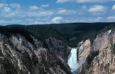 The Grand Canyon of the Yellowstone in Yellowstone National Park is an excellent example of a classic V-shaped valley.
 Several large meanders and an oxbow lake are clearly evident in this satellite image of the Mississippi River.
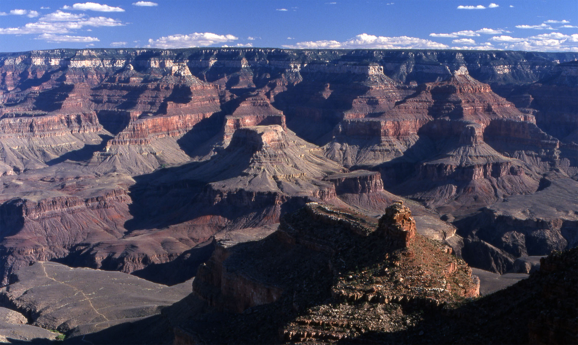 The Grand Canyon, a UNESCO World Heritage site, has a total length of 446 km (277 miles).
Measuring the Grand Canyon
The Grand Canyon in Arizona has been formed over the course of the last 17 million years by the erosive action of the Colorado River. The canyon itself has a maximum depth of 1.83 km (6,000 ft), and a maximum width of 29 km (18 mi).
- Click here to zoom in on a narrow part of the canyon.
- Click here to add in a terrain profile at this part of the Grand Canyon.
The terrain profile shows a cross-section of the canyon.
- Move your mouse over the terrain profile graph. Cross-hairs will appear as you move the cursor.
- Note how the elevation (measured as above sea level) changes as you move the cursor.
- What are the maximum and minimum elevations for our profile? The maximum elevation for our profile is 1712 m and the minimum elevation is 838 m.
- What is the maximum depth of the canyon in our profile? The maximum depth of the canyon in our profile is 655 m (i.e. 1712 m – 838 m = 874 m).
- Which side of the profile (left or right) has the maximum height, and what is this height? What is the height of the lower side? The left side of the profile has a maximum height of 1712 m. The right side of the profile has a height of 1680 m.
- What is the height difference between the two sides of the Grand Canyon here? The two sides of the Grand Canyon at this point have a height difference of 32 m (i.e. 1712 m – 1680 m = 32 m).
- Now change your location and view of the canyon and see how the profile changes. Do this several times.