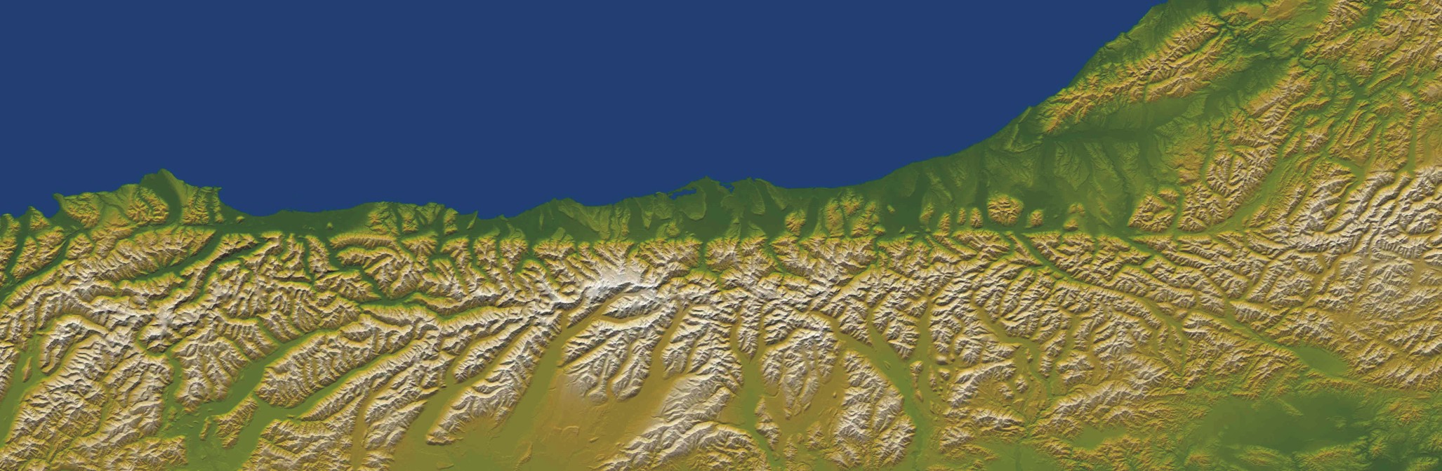
 The Alpine Fault on New Zealand’s South Island is clearly visible in this shot taken from the space shuttle Endeavor at a height of 495 km (307 miles).
A transform fault boundary is an area where two lithospheric plates grind past one another. The San Andreas Fault, illustrated in the screen to the far right, is an example of a transform fault boundary with the Pacific plate “sliding” past the North American plate. Because of their nature, transform boundaries can be quite visible when they occur on land. The Alpine Fault, a transform fault boundary on the South Island of New Zealand is, like the San Andreas Fault, quite visible from outer space. A transform fault boundary is also known as a conservative margin since crust is neither created (i.e., divergent boundary) nor destroyed (i.e., convergent boundary).
Prior to 1965, scientists had been unable to explain a strange series of zigzag lines that had been observed near mid-oceanic ridges. It was J. Tuzo Wilson, a Canadian geophysicist, who accounted for this strange pattern in 1965. Wilson explained that these offset lines were in reality transform fault boundaries between two diverging plates. This explanation provided an elegant solution to what had been a perplexing physical problem.
Where Is Your Boundary?
Tectonic plate boundaries typically have a fair bit of geologic activity associated with them. In this activity, you will determine how far away the nearest plate boundary is from you.
- Click here to see a view of North America along with tectonic plate boundaries.
Locate where you live either by inspection or by using the Search function. Then use the measuring tool to determine the distance from where you are now to the nearest:
- divergent boundary
- convergent boundary
- transform fault boundary