 An autographed photo of Alfred Wegener (1880-1930).
Many individuals over the last few centuries have noted an odd geometric fact. The Atlantic coasts of South America and Africa appear to fit so well together that they almost seem like two pieces of a giant jigsaw puzzle. This led to speculation that perhaps South America and Africa were originally part of one large landmass that over time separated into two separate landmasses.
It was Alfred Wegener, a university lecturer in meteorology (the study of the atmosphere) in Marburg, Germany who first proposed the theory of continental drift in 1912. The theory of continental drift states that the Earth’s continents move over a period of time over the surface of the Earth. Wegener used topographic fit, how the shapes of the continents fit together, as evidence to support his theory of continental drift.
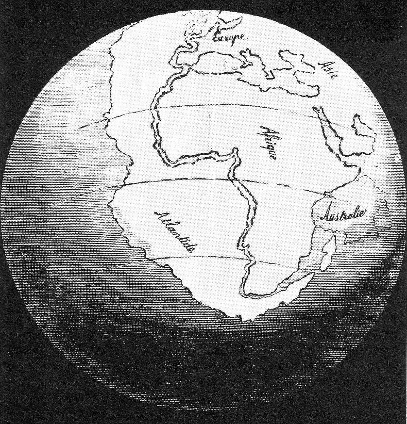 Antonio Snider-Pellegrini was a French geographer who in 1858 published a map showing how South America and Africa might fit together.
Fitting the Continents Together
The continental shelf, found at a depth of approximately 1,000 meters (3,280 feet), represents the true margins of continents. In this activity, you will attempt to fit some of the Earth’s continents together using the continental shelves as the outer perimeter of the continents.
- Select the interactive below to start a simulation that will allow you to move the continents/landmasses that surround the Atlantic Ocean.
 Interactive Animation of Continental Fit.
North America (in green) has been locked in place. Use your mouse cursor to shift the other continents/landmasses around and click-hold and press the spacebar to rotate the continents/landmasses. Try to fit them together as best you can.
- Do all the continents fit together nicely? Describe problem areas that you encountered. Answers to this will vary depending on exactly how you fit the continents together. South America and Africa fit together fairly easily. Greenland fits in quite nicely between North America and Europe. Fitting in Europe can sometimes be a problem.
- Press the Computer Generated Fit button on the simulation to view a computer-generated fit of the continents/landmasses.
- Then press the Overlaps button to view where overlaps occur.
- What are some reasons that there might be overlaps? Overlaps are due to features that have formed since the continents originally separated. These are features such as streams and rivers depositing large bodies of sediment (see the Niger River delta in Africa), coral beds (see Florida), and volcanic activity (see Iceland).